In Plain Sight: Sacred Sites in Mississippi
A family discovers the stories of Native American mounds in the rolling landscape of the Mississippi Hills.
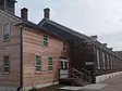
Visitors to Oxford, Mississippi, where I’m an English professor at Ole Miss, often clamber aboard our town’s bright red double-decker bus for a tour. As the bus leaves the historic square, the tourists listen to a spiel about how our town was chartered in 1837, on land previously owned by a Chickasaw princess named Hoka.
Rolling through The Grove, the university’s manicured, tree-studded greenspace, they learn that the school opened its doors in 1848 and was used as a hospital during the Civil War. And as the tour moves past the cedar-lined drive of William Faulkner’s graceful home and turns toward Square Books—generally considered the best bookstore in the South—riders hear of the continuance of the literary tradition, the mantle being passed from William Faulkner to the likes of Barry Hannah and John Grisham and Larry Brown.
It’s a good tour, but after taking it a few times with out-of-town guests, I found myself wondering what came before all of this. What was life like for the area’s inhabitants not merely 200 years ago, but 2,000? Luckily, there are plenty of clues scattered throughout the landscape of the Mississippi Hills National Heritage Area: Native American mound sites, many of which are located along what is now the Natchez Trace Parkway. It’s easy to drive by these mounds and not notice them, in the same way it’s easy for folks who have lived in the state all their lives to use the Natchez, Choctaw, and Chickasaw names for places constantly but offhandedly, forgetting about their native poetry. (For example, Tupelo means “Swamp Tree,” Pontotoc is “Land of Hanging Grapes,” and the Yazoo River, it’s believed, is “River of Death.”)
This past fall, my husband, my three children, and I decided to counter the “drive by” with the “drive to.” We planned a trip to see how many mound sites we could visit within a day’s drive from our home in Oxford, and what we could learn from our efforts.

We began by understanding that these ancient landforms were built by different peoples at different times for different purposes. Mound building here began more than 2,000 years ago and continued sporadically for the next 18 centuries. That wide swath of time spans two archaeological eras: first the Woodland Period, which saw a transition from mobile, seasonal settlements to more permanent, year-round settlements, and then the Mississippian Period, when inhabitants of this region became skilled farmers and artisans.
Archaeologists and historians have determined that hundreds of mounds once existed in the northeastern chunk of Mississippi. Although a vast percentage has disappeared—some eroded, some looted, some bulldozed or plowed under for farmland—and others exist only on private property, dozens of intact sites remain and welcome visitors, many with signage, trails, or even nearby museums.
Before too long, my family and I could usually identify the function of a mound by a quick glance.
Those with rounded, dome-shaped tops, like the Pharr Mounds or Bynum Mound and Village Site outside Tupelo, served as burial grounds for tribal members. The flat-topped ceremonial mounds—such as Owl Creek Mounds, Bear Creek Mound and Village Site, and the Ingomar Mounds—were used for important rituals or social gatherings. Some evidence suggests that, in certain cases, a few elite members of the tribe may have lived atop these platform mounds.
The Ingomar Mounds (pictured at top) outside New Albany were our favorite examples of the flat-topped mound type. Named a state landmark in 2002, they demonstrate both what’s been lost to history and what remains: Originally a 14-mound complex stretching across 70 acres, most of the 2,200-year-old mounds were destroyed—some looted, some plowed over—by the late 1800s. The land is now owned by the nonprofit Archaeological Conservancy, which provides protection and research access.

From left: A Spanish silver artifact found in the 19th century at the Ingomar Mounds, on display at the Union County Museum; The stairway leading to the one-acre platform of Mound 14.
Like this story? Then you'll love our emails. Sign up today.
Visiting the site today basically means visiting Mound 14, the largest of the original mounds. (At 27 feet tall, it was too steep to plow over.) As opposed to the burial mounds, this ceremonial platform allows a bit more of a close-up, stretch-your-legs experience, with a long set of stairs built up the incline.
Among the tall grasses at the top, listening to the metallic screech of cicadas and watching a trio of buzzards circling on the horizon, we got a sense for the first time of how much work must have gone into building such a structure, how many times the builders would have had to fill baskets with dirt and drag them up the steep incline.
At the adjacent Union County Heritage Museum, our kids learned about the daily lives of the mound builders and even attempted to operate an atlatl, a propelling device used by Native Americans to increase the throwing distance of a spear or dart. Since 2004, the museum has partnered with the Archaeological Conservancy to maintain and interpret the Ingomar Mounds. Boy Scout and Eagle Scout projects, astronomy programs, and atlatl throwing competitions are just a few of the activities it offers to help connect visitors to the site.
Although Mound 14 has reforested now, you can see—especially in winter when the trees are bare—how impressive it must have appeared to anyone approaching from across the flat earth. The mound’s height and one-acre platform would inspire awe, its corners crisp and clearly human-made. There’s still so much that even experts don’t know about the Ingomar Mounds; below the surface, different colors of clay were packed in alternating layers, but for what purpose, archaeologists can only guess. “There’s a lot that we may never know,” says the Archaeological Conservancy’s Jessica Crawford.

As for the dome-shaped burial mounds, the largest ones in the area are the wavelike Pharr Mounds, a 30-minute drive northeast of Tupelo, around mile marker 286 on the Natchez Trace Parkway. We stayed overnight in a cabin at Trace State Park for this part of our mounds education; another good cabin-rental option near the Pharr Mounds is Tishomingo State Park, named after a historic leader of the Chickasaw Nation.
Built at least 1,800 years ago, Pharr Mounds comprises eight large, rounded landforms, scattered over an area of 90 acres. There’s nothing visible left now of the village nearby, but a 1966 National Park Service excavation showed that the site was home to vigorous trading. In addition to gravesites and decorative ceramics, non-local artifacts such as a greenstone platform pipe and ear-spools made from Great Lakes copper were also uncovered, demonstrating the reach of the Middle Woodland Period trading network. (Today, rather than excavating sacred burial sites, researchers and archaeologists would rely on non-invasive techniques, such as ground-penetrating radar.)
At the Parkway Visitor Center along the Natchez Trace, Chief of Interpretation Terry Wildy suggested we think of these particular mounds as a church and a cemetery put together. And a ranger explained to my 10-year-old son that the Pharr Mounds should be viewed at a distance—not only because you can gain a sense of how they were grouped, but also because “they are not to be used as, say, a picnic spot.” The spiritually significant mounds might serve as a place to reflect, or, as is the case for the Chickasaws who often journey here from tribal headquarters in Ada, Oklahoma, a place to honor ancestors.
The next time my family and I are on the double-decker bus tour with out-of-town visitors, we’ll be able to tell them there’s more to our hometown than the buildings we see there now. We feel the embrace of history in a way we hadn’t before, our mounds tour linking us to the stories of the land from way before the bus tour began.When You Go

A gracious balcony tops the entrance to City Grocery in Oxford.

The signature meal at Latham's Hamburger Inn in New Albany.

Diners at Kermit’s Outlaw Kitchen in Tupelo.

Johnnie's Drive In, an Elvis Presley favorite.

A quiet moment at Trace State Park.

A statue of a young Elvis at the Elvis Presley Birthplace in Tupelo.

At the Elvis Presley birthplace, visitors wait in line to tour the modest two-room house.

Tupelo Hardware, where Elvis got his first guitar.

A 1930s cabin at Tishomingo State Park.
After a day of exploring Native American mound sites in the Mississippi Hills, you’ll need a place to refuel and lay your head. Consider these dining and lodging options, and visit places associated with Tupelo-born Elvis Presley for good measure.
* * *
OXFORD
- City Grocery
The shrimp and grits, prepared by James Beard Award–winning chef John Currence, are justly famous. A balcony at the upstairs bar overlooks the town square. - Square Books
Since 1979, this store on the historic town square has been a great place to load up on Faulkner (and caffeine). In 2013, Publishers Weekly named it Bookstore of the Year. - Latham’s Hamburger Inn
This crowd favorite opened in a trolley car more than 80 years ago and still sells its secret-recipe Original Latham’s Burger for $2.50 a pop. Wash your burger down like a local, with a Coca-Cola in a glass bottle. - Vintage Market and Old Time Soda Fountain
The best place to earn your calories before burning them off climbing the Ingomar Mounds.
TUPELO
- Kermit’s Outlaw Kitchen
Housed in a 140-year-old building downtown, Kermit’s features meals made with local ingredients and prepared on a wood-burning hearth grill. - Johnnie’s Drive In
Rumored to serve Elvis’ preferred burgers, shakes, and fries. Grab a seat in his favorite booth, second from the kitchen against the wall. - Trace State Park
Fishing and hiking are easy diversions in this state park. Two-room cabins cost around $90 a night. - Elvis Presley Birthplace
The two-room house where the King was a little prince is open to the public seven days a week. - Tupelo Hardware Company
This downtown store contains long rows of bins selling everything you could need to fix anything you could imagine. A duct tape “X” marks the spot where 11-year-old Elvis stood when he considered buying a .22 rifle. (His mother talked him into buying his first guitar instead.)
TISHOMINGO
- Tishomingo State Park
About 22 miles northeast of the Pharr Mounds, this verdant park is named after a historic leader of the Chickasaw Nation, Chief Tishomingo. Six of the seven rental cabins there were built by the Civilian Conservation Corps in the mid-1930s, using mostly stone and wood to suit the forest setting.